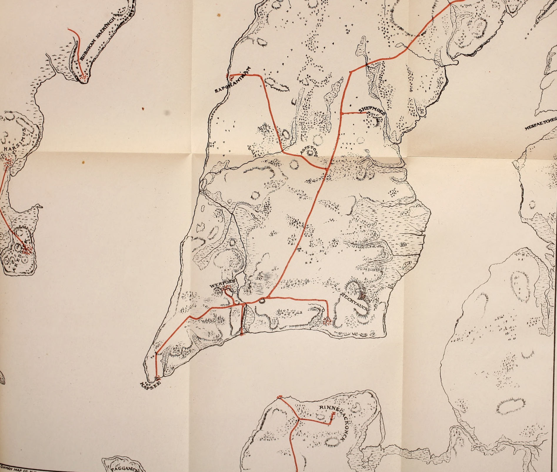
A fascinating map showing the native paths in lower Manhattan as they appeared before European settlement. From Indian Paths in the Great Metropolis, by Reginald Pelham Bolton.
The original people have lived for thousands of years in the area that is now Greater New York. Several shared the island of Mannahatta, a part of Lenapehoking, the land of the Lenape. They travelled across the rivers and estuaries to reach important seasonal campsites, fishing villages, and meeting places on the island. Depending on who was speaking, what is now Manhattan island could be called “the island,” “the island of many hills,” “place for gathering bow wood,” or perhaps even “place of general intoxication” (note that the translation for this is shaky, and it is generally accepted to be incorrect, although it could be considered a good application for modern-day Manhattan!).
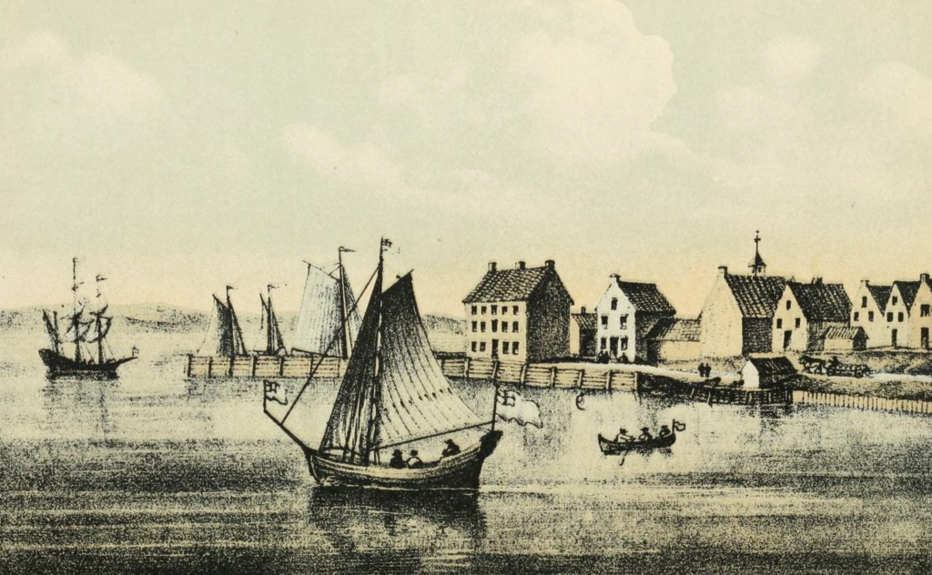
The bottom of Manhattan, showing where the Kapsee was located, as it appeared in 1679. The Dutch extended the canoe landing into a public dock, which is off to the right. From Valentine’s Manual of the City of New York, edited by Henry Collins Brown, 1921.
At the tip of the island was a rocky landing known as the Kapsee, “the point of rocks.” A trail led up the gentle slope of the island, called the Wickquasgeck Trail, as it wound up Manhattan and reached the land utilized by that group, in what is now lower Westchester and the Western part of the Bronx. It is also sometimes referred to as the Mohican Trail, as it continued far north to their communities in what is now upstate New York. At the tip of the island, the wide trail followed the low land along its western side, and seeing this the Dutch called it De Breede Weg, later Anglicized to Broadway.
Werpoes and The Collect Pond
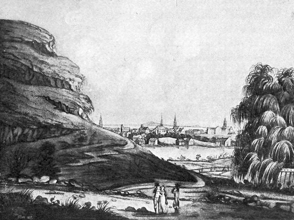
The Collect Pond, c. 1798. It was a tremendously popular spot for fishing and ice-skating up through the 18th century. Bayard’s Mount is to the left. From Valentine’s Manual of the City of New York, edited by Henry Collins Brown, 1924.
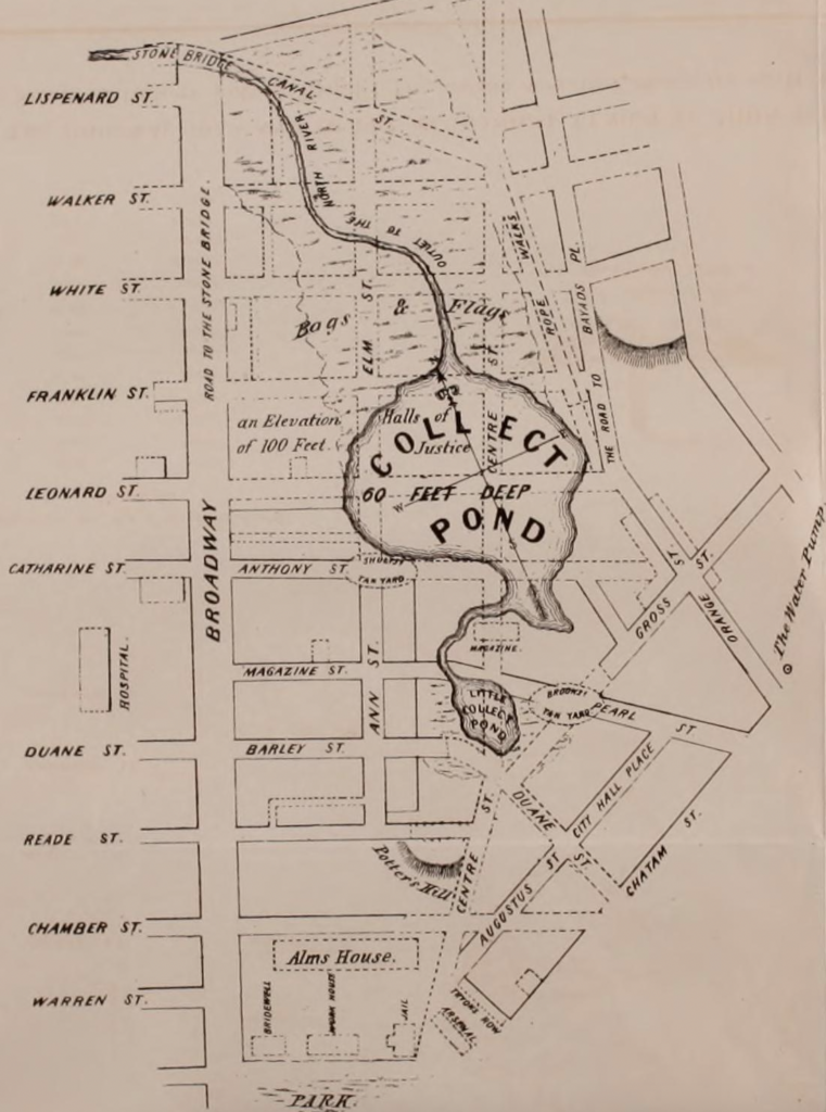
The course of the Collect, with the street grid of the time. It shows the swampy land to the north and the stream that led to the Hudson River. As the city expanded around the pond, the adjoining land became a tannery district, and chemicals and offal were thrown into the water, greatly polluting it. A canal was built to empty the pond (the namesake of Canal Street), and it was later filled in with dirt from Bayard’s Mount. From Documentary History of the State of New York Volume II, edited by E.B. O’Callaghan, 1849.
Near the site of what is now City Hall Park, the trail gently turned, following the topography of the island and continuing to the largest settlement in the area. Called Werpoes, the “beautiful field by the thicket,” it was located near the lush banks of a freshwater kettle pond. The land was fed by numerous springs, which facilitated the cultivation of crops in the fertile soil. The springs, surrounded by marshy land, would occasionally flood, temporarily severing the bottom of the island.
Like many others, Werpoes was likely a seasonal settlement that most left in the winter, moving to more secure locations off of the island. The Lenape who lived in and visited the village left a considerable number of shells behind in a midden, prompting the Dutch to call the nearby pond Kalch-Hoek, “lime shell point,” which was Anglicized to Collect. It was protected on one side by a series of hills including what was later called Bayard’s Mount, which was the largest hill in lower Manhattan, rising 110 feet.
Kieft’s War
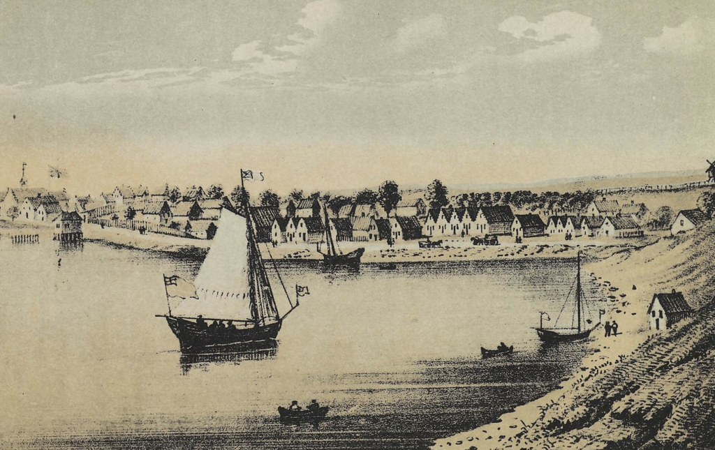
A view of New-York from what is now Corlear’s Hook, with the sandy land leading down to the river’s edge. 1679. Rechtanc was located to the right. From Valentine’s Manual of the City of New York, edited by Henry Collins Brown, 1921.
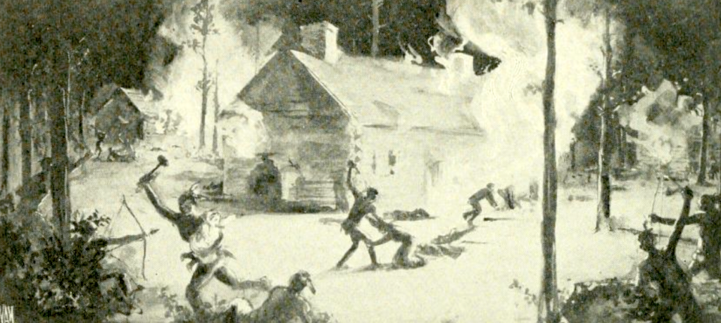
The massacre of Anne Hutchinson and her family, 1643. Hutchinson, a Puritan dissenter who had been excommunicated, had left Rhode Island after being harassed by ministers, and sought refuge in New Netherland. She settled in what is now Pelham Bay in the Bronx with several of her followers, who were killed by a group of Siwanoy who were responding to the Dutch attacks. The war would continue on for two more years. From The Borough of the Bronx, 1639-1913 by Harry T. Cook.
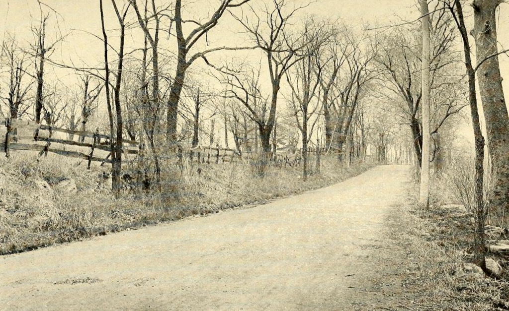
The Split Rock Road, a native path that crossed nearby Hutchinson’s home and the river that was named after her. From Indian Paths in the Great Metropolis, by Reginald Pelham Bolton.
The trail continued until it forked, with a branch leading to a seasonal fishing encampment known as Rechtanc, “sandy wading place.” In 1643, this was the site of a bloody massacre during the bloody Kieft’s War, named after New Netherland Director Willem Kieft, who shortly after arriving in New Netherland demanded that native groups pay for so-called protection, which caused much anger.
As tensions mounted, Kieft took advantage of the killing of wheelwright Claes Swits, which was perhaps a retaliation for the murder of several native traders 15 years prior, and used this as a pretense to attack the group which he thought was responsible for harboring the killer. Ignoring the advice of a council that advised that only the single killer be held to account, Kieft ordered Dutch West India Company soldiers to assault native settlements.
In February 1643, they violently attacked a native settlement across the river in Pavonia (encompassing the settlement at Harsimus, which meant “crow’s nest”), and the same night massacred at least 40 natives at Rechtanc. These brutal atrocities led to a full-scale war, with native groups banding together to avenge those who were murdered, causing settlers to flee to the protection of New Amsterdam, decimating farms and settlements across the colony (Anne Hutchinson also became a casualty of the conflict), and destabilizing Dutch control of the region.
A Crossroads at Astor Place
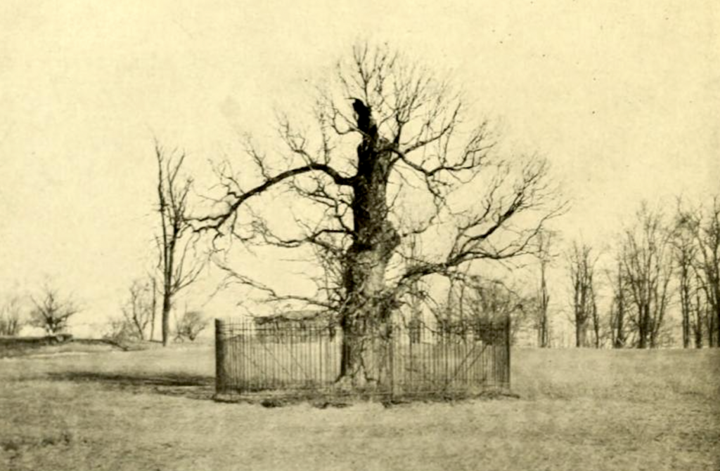
The Pell Treaty Oak, c. 1900. A treaty was signed here between Thomas Pell and the Siwanoy natives in 1654. Oaks, elms, and other trees like this were often the site of important treaties between native groups, and later between settlers and natives. From The Story of the Bronx by Stephen Jenkins.
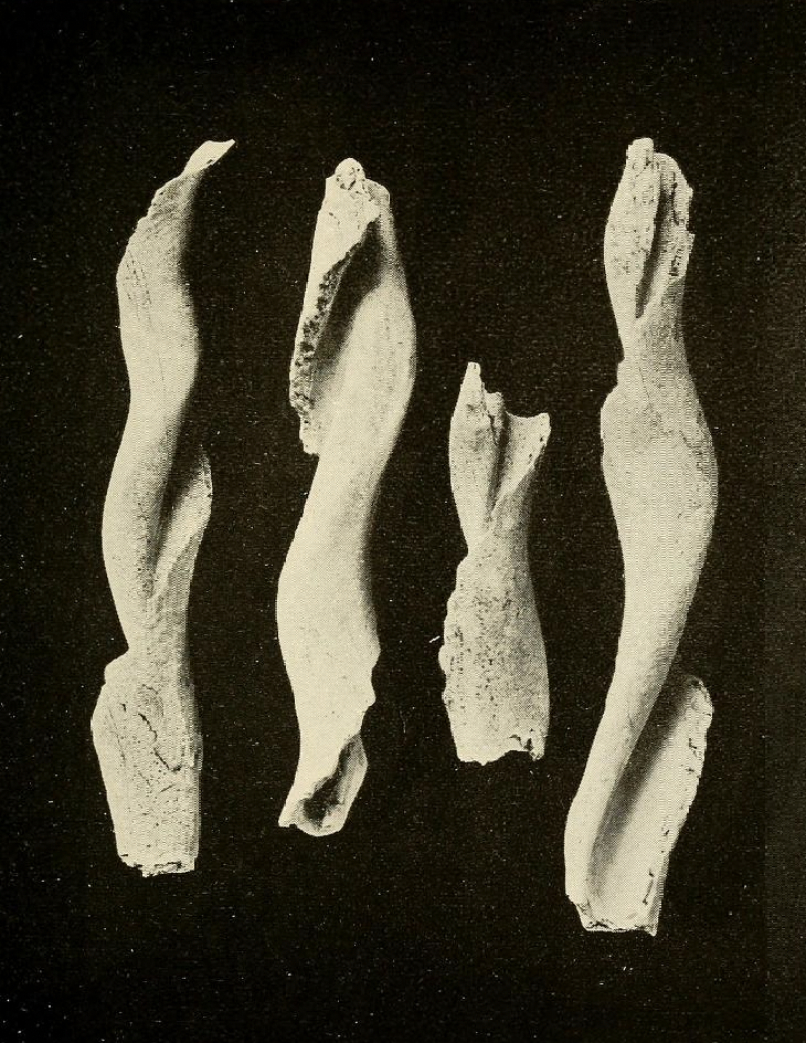
Shells prepared for the making of wampum. From Archaeological Investigations on Manhattan Island by Alanson Skinner.
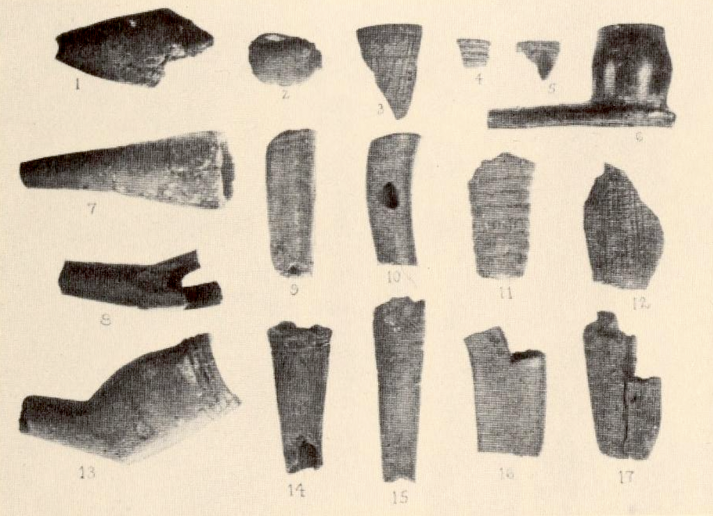
Fragments of the kind of tobacco pipes that could be found in and around Lenapehoking. These were excavated from a site near Mariner’s Harbor in Staten Island. From Indians of Greater New York and the Lower Hudson by Clark Wissler.
The main trail turned to the north, and continued along the low land to Kintecoying, “crossroads of three nations” (also called Aspetonc or Aspetong, “the elevated place”). Here there likely was a great council elm or oak, under which members of the Lenape groups that shared use of Manhattan would meet. Their sachems would give speeches to the people, respected members would engage in local diplomacy, and folks would trade goods brought from places near and far. Echoes of this meeting place can still be felt, as it remains a popular site for New Yorkers to gather and rotate The Cube (Tony Rosenthal’s Alamo sculpture) on Astor Place.
The groups may have played games of bagettaway, “the creator’s great game,” which the French called lacrosse, from the later French “jeu de la crosse,” on the wide sandy plain to the east. Stretching west from the meeting place was the road to Sapokanikan, “tobacco field,” along the banks of the Manette creek, “devil’s water,” later corrupted to Minetta. The bend in Minetta Street follows the water’s crooked path.
Sapokanikan featured a trading post along the river, which offered easy access to those canoeing in from across the river. Wampum, made of white and purple beads hand-drilled from whelk and clam shells, respectively, were strung together into necklaces and belts, with longer belts of many fathoms crafted for significant treaties. For many years, the Dutch settlers of New Netherland used wampum as a de facto currency.
Crooked Little Swamp
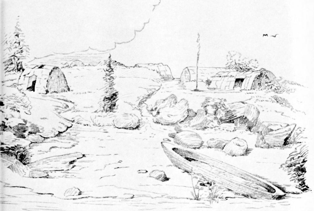
A depiction of a village, dubbed Weir Creek, which was located along Eastchester Bay. The villages and campsites in Manhattan may have had similar features. From Indian Life of Long Ago in the City of New York by Reginald Pelham Bolton, 1934.
Across Manhattan to the east was a campsite called Shepmoes, “by the little river,” which flowed through Shepmoes Creek. The Dutch called this area Krom Moerasje, “crooked little swamp, which later became Gramercy. Shepmoes could easily be reached from natives coming in from Long Island, called Paumanok, “place of tribute,” or Sweanhaka, “place of shells,” both attesting to the groups on the island who crafted the precious wampum and traded it on Manhattan island and beyond.
Stay tuned for Part 2: Native Paths in Upper Manhattan!